Southern Sayaboury Province: a diversity of geomorphological conditions
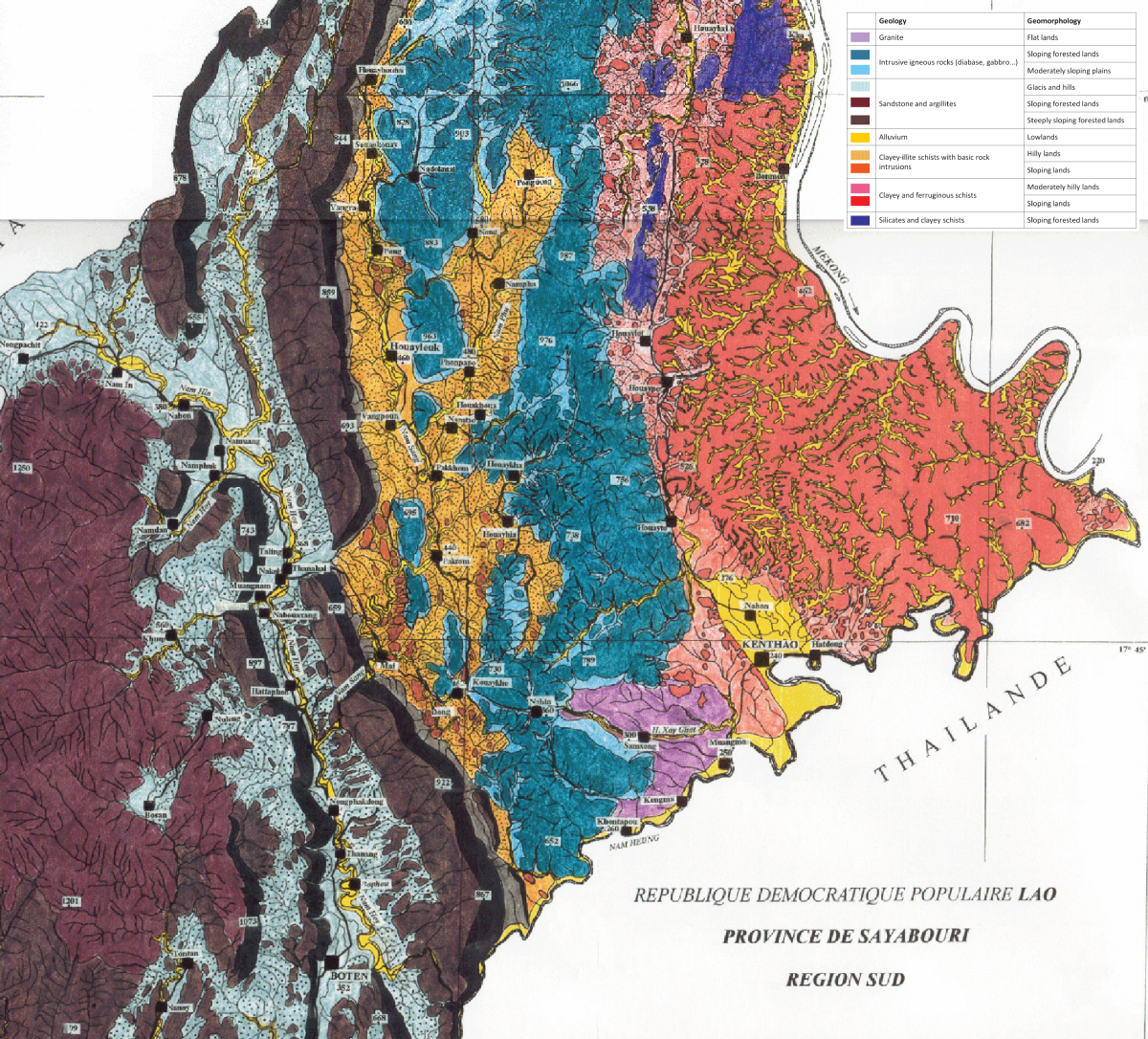 | Southern Sayaboury province spans three main geomorphological zones with different characteristics in terms of slope, soil erosion risk and soil fertility. As represented on the map on the right, from the border with Thailand (West) to the Mekong river (East), these zones include:
As a result of these different slope and soil characteristics, the three broad areas also have different potential for agriculture, with the most productive lands being found in the central, clayey-illite schist area |
Source: Raunet (1996)
