
Patterns of land use intensification
As a result of environmental conditions, agricultural and market drivers, and reflecting the impacts of the "maize boom" on land use and smallholder agriculture, the two study regions have differentiated into four main agroecological zones. These different zones correspond to successive stages in a historical pattern of land use intensification. The following diagram represents the four stages of land use intensification according to accessibility, market integration and capital outflows from early transitional areas (stage 4) towards pioneer areas (stage 1).
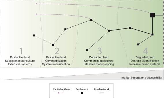
On the bottom, the gray triangle represents a dual gradient of increasing accessibility and market integration (from the left to the right). The road network, represented by links between settlement nodes, becomes increasingly dense as we move from stage 1 to stage 4. Capital accumulated in stages 3 and 4 is being reinvested to support the transition in stages 1 and 2.


